Дѣло:EU-Austria.svg

Size of this PNG preview of this SVG file: 713 × 600 пиѯєлъ. Other resolutions: 285 × 240 пиѯєлъ | 571 × 480 пиѯєлъ | 913 × 768 пиѯєлъ | 1.218 × 1.024 пиѯєлъ | 2.435 × 2.048 пиѯєлъ | 2.045 × 1.720 пиѯєлъ.
источьнъ дѣла обраꙁъ (дѣло SVG · обꙑчьнъ обраꙁъ : 2.045 × 1.720 п҃ѯ · дѣла мѣра : 7,33 MB)
| Сь видъ Викикладѣ (Wikimedia Commons) съхранѥнъ ѥстъ ⁙ Cѥ ѥгожє опьсаниѥ ѥстъ |
опьсаниѥ
| опьсаниѥ |
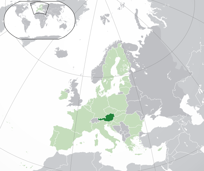
English: (Dark-Green) Austria. (Light-Green) The rest of the European Union (EU). (Dark-gray) The rest of Europe. (Light-gray) The surrounding region.
See also: |
| SVG genesis | |
| врѣмѧ сътворѥниꙗ | |
| кладѧꙃь | Own work based on: Location European nation states.svg |
| творьць | NuclearVacuum |
| Other versions |
|
| SVG genesis |


прощєниѥ
I, the copyright holder of this work, hereby publish it under the following licenses:
сѥ́ дѣ́ло по́дъ прощє́ниѥмь Creative Commons Attribution-Share Alike 3.0 Unported положєно ѥ́стъ
- тꙑ можєши :
- прострѣти – to copy, distribute and transmit the work
- прѣвращати – прѣтворити дѣло
- Under the following conditions:
- attribution – You must give appropriate credit, provide a link to the license, and indicate if changes were made. You may do so in any reasonable manner, but not in any way that suggests the licensor endorses you or your use.
- share alike – ащє жє сѥ дѣло иꙁмѣниши · прѣвратиши или ѥгожє основѣ нѣчьто сътвориши · тъ авлѥно слѣдьствиѥ подъ самомь тѣмь прощєниѥмь или подобьномь ѥмоу положити длъжєнъ ѥси

|
Permission is granted to copy, distribute and/or modify this document under the terms of the GNU Free Documentation License, Version 1.2 or any later version published by the Free Software Foundation; with no Invariant Sections, no Front-Cover Texts, and no Back-Cover Texts. A copy of the license is included in the section entitled GNU Free Documentation License. |
прощєниѥ иꙁбрати можєши
дѣла їсторїꙗ
Click on a date/time to view the file as it appeared at that time.
| дьнь / врѣмѧ | малъ обраꙁъ | мѣра | польꙃєватєл҄ь | опьсаниѥ | |
|---|---|---|---|---|---|
| нꙑнѣщьн҄ь обраꙁъ | 04:30, фєвроуарїꙗ 1 числа, 2020 | | 2.045 × 1.720 (7,33 MB) | Rob984 | UK and Gibraltar have left the EU. New base which includes all of Portugal's islands within frame, as well as Arctic Russian islands part of Europe. Also fixed Flevoland in the Netherlands. |
| 18:58, октѡврїꙗ 25 числа, 2016 |  | 2.045 × 1.720 (7,33 MB) | Giorgi Balakhadze | + | |
| 09:21, дєкємврїꙗ 24 числа, 2015 |  | 2.045 × 1.720 (7,33 MB) | Nordwestern | Per original framework and Commons' rules. Agree with A2D2. | |
| 16:24, мартїꙗ 18 числа, 2015 |  | 2.045 × 1.720 (7,38 MB) | Mapclean | Reverted to Leftcry's version, please go to your talk page | |
| 14:02, фєвроуарїꙗ 21 числа, 2015 |  | 2.045 × 1.720 (2,62 MB) | VS6507 | Spain. Greece. Slovakia. Cyprus. Romania VETO | |
| 19:33, ноємврїꙗ 16 числа, 2014 |  | 2.045 × 1.720 (7,38 MB) | Leftcry | Reverted to version as of 22:30, 18 October 2014 Please go to your talk page | |
| 16:17, ноємврїꙗ 16 числа, 2014 |  | 2.045 × 1.720 (2,62 MB) | A2D2 | The map must show the original de-jure status with no breakaway regions, as it was originally created. An alternative map showing the de-facto status with breakaway regions needs to created instead. | |
| 15:40, ноємврїꙗ 16 числа, 2014 |  | 2.045 × 1.720 (7,38 MB) | A2D2 | Reverted to version as of 21:04, 18 October 2014 | |
| 22:30, октѡврїꙗ 18 числа, 2014 |  | 2.045 × 1.720 (7,38 MB) | Leftcry | Minor fix | |
| 21:07, октѡврїꙗ 18 числа, 2014 |  | 2.045 × 1.720 (7,38 MB) | Leftcry | Minor fix |
дѣла польꙃєваниѥ
The following page uses this file:
Global file usage
инꙑ мѣста къдє сѥ дѣло польꙃєвано ѥстъ :
- польꙃєваниѥ въ ady.wikipedia.org
- польꙃєваниѥ въ af.wikipedia.org
- польꙃєваниѥ въ als.wikipedia.org
- польꙃєваниѥ въ ami.wikipedia.org
- польꙃєваниѥ въ an.wikipedia.org
- польꙃєваниѥ въ ar.wikipedia.org
- النمسا
- معاملة المثليين في النمسا
- مستخدم:ElWaliElAlaoui/ملعب 8
- مستخدم:جار الله/قائمة صور مقالات العلاقات الثنائية
- العلاقات النمساوية الأمريكية
- العلاقات الأنغولية النمساوية
- العلاقات النمساوية الكورية الجنوبية
- العلاقات النمساوية الإريترية
- العلاقات النمساوية السويسرية
- العلاقات الألمانية النمساوية
- العلاقات النمساوية الليختنشتانية
- العلاقات النمساوية البوليفية
- العلاقات النمساوية الموزمبيقية
- العلاقات الألبانية النمساوية
- العلاقات النمساوية البلجيكية
- العلاقات النمساوية الإثيوبية
- العلاقات النمساوية البيلاروسية
- العلاقات النمساوية الطاجيكستانية
- العلاقات النمساوية الروسية
- العلاقات النمساوية الرومانية
- العلاقات الأرجنتينية النمساوية
- العلاقات النمساوية الغامبية
- العلاقات النمساوية القبرصية
- العلاقات النمساوية السيراليونية
- العلاقات النمساوية النيبالية
- العلاقات النمساوية الليبيرية
- العلاقات التشيكية النمساوية
- العلاقات النمساوية الميانمارية
- العلاقات النمساوية الكندية
- العلاقات النمساوية الزيمبابوية
- العلاقات النمساوية الإسرائيلية
- العلاقات النمساوية البالاوية
- العلاقات النمساوية المالية
- العلاقات النمساوية النيجيرية
- العلاقات النمساوية اليمنية
- العلاقات النمساوية الفانواتية
- العلاقات الغابونية النمساوية
- العلاقات النمساوية البنمية
- العلاقات النمساوية الكوبية
- العلاقات النمساوية الجورجية
- العلاقات النمساوية التونسية
- العلاقات النمساوية الكورية الشمالية
- العلاقات النمساوية الهندية
- العلاقات النمساوية اليابانية
View more global usage of this file.