Дѣло:Lanersbach.jpg
Size of this preview: 800 × 534 пиѯєлъ. Other resolutions: 320 × 214 пиѯєлъ | 640 × 427 пиѯєлъ | 1.024 × 684 пиѯєлъ | 1.280 × 855 пиѯєлъ | 2.560 × 1.710 пиѯєлъ | 4.240 × 2.832 пиѯєлъ.
источьнъ дѣла обраꙁъ (4.240 × 2.832 п҃ѯ · дѣла мѣра : 5,34 MB · MIME тѷпъ : image/jpeg)
| Сь видъ Викикладѣ (Wikimedia Commons) съхранѥнъ ѥстъ ⁙ Cѥ ѥгожє опьсаниѥ ѥстъ |
опьсаниѥ
![]() Аѵстрїꙗ
Аѵстрїꙗ ![]() Land Tirol
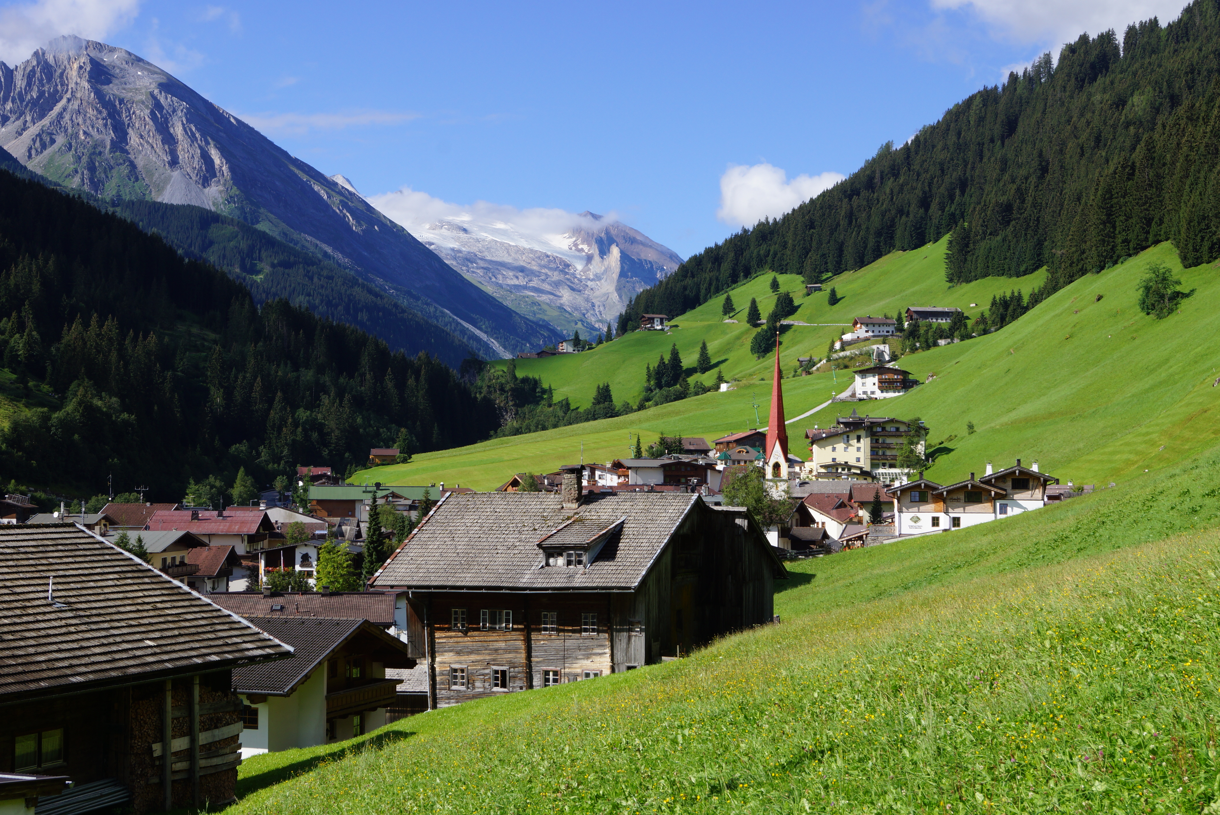
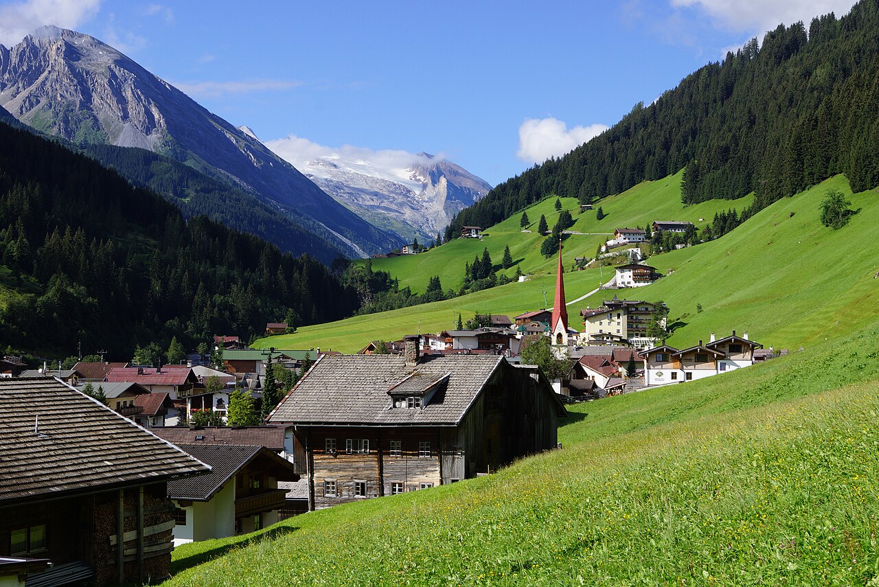
Land Tirol ![]() Tux - Tuxer Alpen 1.281 m ü. A.
Tux - Tuxer Alpen 1.281 m ü. A.
| опьсаниѥ |
Deutsch: Tuxertal: Wir schauen von Lanersbach (Ortsrand nahe Seilbahn-Talstation auf 1.290 m) talein in südwestlicher Richtung zum Hintertuxer Gletscher. Diese Talseite (orografisch links) gehört zu den Tuxer, die jenseitige zu den Zillertaler Alpen. |
| врѣмѧ сътворѥниꙗ | Taken on 7 аѷгоустъ 2012, 09:33:03 |
| кладѧꙃь | своѥ творѥниѥ |
| творьць | FkMohr |
| Camera location | | View this and other nearby images on: OpenStreetMap |
|---|
T {BF120807-0933}
прощєниѥ
Friedrich-Karl Mohr, the copyright holder of this work, hereby publishes it under the following license:
сѥ́ дѣ́ло по́дъ прощє́ниѥмь Creative Commons Attribution-Share Alike 3.0 Germany положєно ѥ́стъ
Attribution: Friedrich-Karl Mohr
- тꙑ можєши :
- прострѣти – to copy, distribute and transmit the work
- прѣвращати – прѣтворити дѣло
- Under the following conditions:
- attribution – You must give appropriate credit, provide a link to the license, and indicate if changes were made. You may do so in any reasonable manner, but not in any way that suggests the licensor endorses you or your use.
- share alike – ащє жє сѥ дѣло иꙁмѣниши · прѣвратиши или ѥгожє основѣ нѣчьто сътвориши · тъ авлѥно слѣдьствиѥ подъ самомь тѣмь прощєниѥмь или подобьномь ѥмоу положити длъжєнъ ѥси

| Annotations | This image is annotated: View the annotations at Commons |
дѣла їсторїꙗ
Click on a date/time to view the file as it appeared at that time.
| дьнь / врѣмѧ | малъ обраꙁъ | мѣра | польꙃєватєл҄ь | опьсаниѥ | |
|---|---|---|---|---|---|
| нꙑнѣщьн҄ь обраꙁъ | 19:37, сєптємврїꙗ 22 числа, 2012 | | 4.240 × 2.832 (5,34 MB) | FkMohr | User created page with UploadWizard |
дѣла польꙃєваниѥ
The following page uses this file:
Global file usage
инꙑ мѣста къдє сѥ дѣло польꙃєвано ѥстъ :
- польꙃєваниѥ въ bg.wikipedia.org
- польꙃєваниѥ въ bn.wikipedia.org
- польꙃєваниѥ въ ceb.wikipedia.org
- польꙃєваниѥ въ cs.wikipedia.org
- польꙃєваниѥ въ cy.wikipedia.org
- польꙃєваниѥ въ de.wikipedia.org
- польꙃєваниѥ въ en.wikipedia.org
- польꙃєваниѥ въ et.wikipedia.org
- польꙃєваниѥ въ fa.wikipedia.org
- польꙃєваниѥ въ fr.wikipedia.org
- польꙃєваниѥ въ hr.wikipedia.org
- польꙃєваниѥ въ nl.wikipedia.org
- польꙃєваниѥ въ pl.wikipedia.org
- польꙃєваниѥ въ pt.wikipedia.org
- польꙃєваниѥ въ ru.wikipedia.org
- польꙃєваниѥ въ sk.wikipedia.org
- польꙃєваниѥ въ sv.wikipedia.org
- польꙃєваниѥ въ www.wikidata.org