Дѣло:Map of USA MA.svg

Size of this PNG preview of this SVG file: 286 × 186 пиѯєлъ. Other resolutions: 320 × 208 пиѯєлъ | 640 × 416 пиѯєлъ | 1.024 × 666 пиѯєлъ | 1.280 × 832 пиѯєлъ | 2.560 × 1.665 пиѯєлъ.
источьнъ дѣла обраꙁъ (дѣло SVG · обꙑчьнъ обраꙁъ : 286 × 186 п҃ѯ · дѣла мѣра : 167 Х҃Б)
| Сь видъ Викикладѣ (Wikimedia Commons) съхранѥнъ ѥстъ ⁙ Cѥ ѥгожє опьсаниѥ ѥстъ |
Clickable version
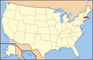
| опьсаниѥ | Map of USA with Massachusetts highlighted | ||||||||
| врѣмѧ сътворѥниꙗ | see file history below. | ||||||||
| кладѧꙃь | own work by uploader, based on Image:Map of USA without state names.svg | ||||||||
| творьць |
This version: uploader Base versions this one is derived from: originally created by en:User:Wapcaplet |
||||||||
| Permission (Reusing this file) |
сѥ дѣло подъ прощєниѥмь Creative Commons Attribution 2.0 Generic положєно ѥстъ
|
||||||||
| Other versions | image:Map of USA with state names.svg |

дѣла їсторїꙗ
Click on a date/time to view the file as it appeared at that time.
| дьнь / врѣмѧ | малъ обраꙁъ | мѣра | польꙃєватєл҄ь | опьсаниѥ | |
|---|---|---|---|---|---|
| нꙑнѣщьн҄ь обраꙁъ | 07:00, їоунїꙗ 9 числа, 2006 | | 286 × 186 (167 Х҃Б) | Huebi~commonswiki | {{Information| |Description=Map of USA with Massachusettes highlighted |other_versions=image:Map of USA with state names.svg }} Category:Maps of the United States Category:Maps of Massachusettes Category:SVG maps {{GFDL-en}}{{cc-by-2.0} |
дѣла польꙃєваниѥ
The following page uses this file:
Global file usage
инꙑ мѣста къдє сѥ дѣло польꙃєвано ѥстъ :
- польꙃєваниѥ въ af.wikipedia.org
- польꙃєваниѥ въ ang.wikipedia.org
- польꙃєваниѥ въ arc.wikipedia.org
- польꙃєваниѥ въ ay.wikipedia.org
- польꙃєваниѥ въ az.wiktionary.org
- польꙃєваниѥ въ ba.wikipedia.org
- польꙃєваниѥ въ bcl.wikipedia.org
- польꙃєваниѥ въ be-tarask.wikipedia.org
- польꙃєваниѥ въ bi.wikipedia.org
- польꙃєваниѥ въ bpy.wikipedia.org
- польꙃєваниѥ въ bxr.wikipedia.org
- польꙃєваниѥ въ ca.wikipedia.org
- польꙃєваниѥ въ ce.wikipedia.org
- польꙃєваниѥ въ co.wikipedia.org
- польꙃєваниѥ въ cs.wikipedia.org
- Administrativní dělení Spojených států amerických
- Cambridge (Massachusetts)
- Winchendon
- Uxbridge (Massachusetts)
- Provincetown
- Williamstown (Massachusetts)
- Leicester (Massachusetts)
- South Deerfield
- Sterling (Massachusetts)
- Salem (Massachusetts)
- Beverly (Massachusetts)
- Peabody (Massachusetts)
- Concord (Massachusetts)
- Foxborough
- Amherst
- Webster (Massachusetts)
- Fitchburg (Massachusetts)
- Oxford (Massachusetts)
- Shrewsbury (Massachusetts)
- Berlin (Massachusetts)
- польꙃєваниѥ въ cv.wikipedia.org
- польꙃєваниѥ въ da.wikipedia.org
View more global usage of this file.